A Coast Walk Planned Around One Good Question
Plan a coast walk around one question to see how paths, buildings, and the shore shape movement, views, and access along a public waterfront route.
The common mistake on a coast walk is trying to notice every feature at once; the cost is a collection of details with no clear connection. A coast walk organized around one question makes it easier to see how a public route shapes the experience of a waterfront.
Try asking: What can a person do along this route: move beside the water, stop to look, reach the shore, or continue inland? This keeps attention on the route’s practical effects rather than guessing why a wall, building, or path was designed a certain way. Choose a public path you know is open, and leave room to pause safely.
Choose a route with a clear change in use
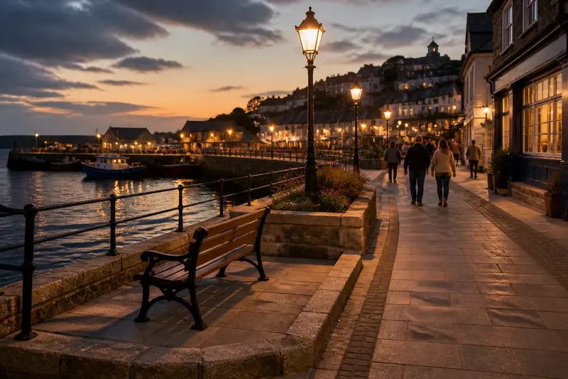
A useful walk does not need dramatic coastal features. Select a stretch where the route changes how people move or spend time: a promenade may allow a steady waterside walk, while a row of shops may draw foot traffic inland or interrupt a direct line along the shore.
Begin at a public access point and follow the route until its use changes noticeably. You might reach a place to sit, a crossing into a town street, or a point where the path no longer runs beside the water. Check local access information and signs before setting out; follow closures and stay out of private or restricted areas.
Describe what the route lets people do
At a few pauses, record an observable action the layout permits or limits. Can a person keep walking beside the water, stop without blocking others, reach the beach, or see the shore from the path? These questions focus on how the place works for someone using it, not on an unverified explanation of its design.
- Continuous movement: If the path follows the water without a visible break, note where someone can keep walking; if it ends or turns inland, record where the route changes and consider following the signed public way instead.
- Places to pause: If a bench or widened area provides space to stop, note what can be seen from there; if stopping would obstruct the path, keep moving and choose a safer public place to observe.
- Access to the shore: If a signed public ramp or opening leads toward the water, record where it begins; if a barrier or closure blocks access, remain on the public route rather than trying to pass it.
- Visibility: If the water is visible, note the point from which the view opens; if a building, vegetation, or bend blocks it, record where the view closes and continue without seeking an unauthorized vantage point.
- Connections to town: If a crossing or street links the waterfront path to nearby shops or public spaces, note where people can turn inland; if no public connection is apparent, describe the route as it is rather than assuming one exists.
- Room to move: If the path allows people to pass comfortably, note where that space continues; if it narrows or becomes crowded, avoid stopping there and record the change from a safer spot.
A few observations about movement and use can explain more than a long inventory of walls, signs, and paving.
Keep observation separate from explanation
Write what you can see before suggesting what it might mean. “The path passes behind the shops, and the water is no longer visible” is an observation; “the shops were placed there to shield the town” is an explanation that cannot be established from appearance alone.
You can preserve a question without turning it into a claim. For instance, note that a gate restricts passage and add “Does this mark a managed area?” as an open question to check later with local information.
Make notes that explain a route’s change
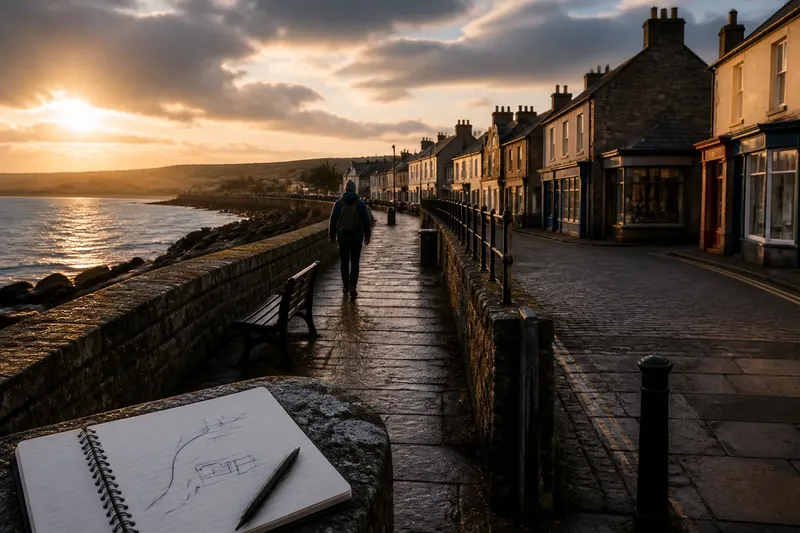
Use a pocket notebook or a phone and keep each note brief: where you are, what action the route permits, and what changes next. A simple sketch can show the path as an arrow, the water as a line, and a building or barrier as a block. Avoid recording people’s identifying details.
Say you start on a public promenade beside a low wall, with a clear view of the water. Farther along, the route turns behind a row of shops and the shore disappears from view. Your notes might read: “Walk beside water beside low wall; after the shops, turn inland and lose the view.” That record shows a shift from continuous waterside movement to town-side movement without claiming why the shops or path were arranged that way.
If you take a photograph, frame the route and the point where its use changes, rather than collecting isolated pictures of signs or structures. A photograph can help you remember the scene, but it cannot establish the feature’s purpose.
What do readers often ask about coast walks?
What should you bring on a short coast walk?
Wear footwear suited to the public path and current conditions, and bring a notebook or charged phone if you want to make notes. Check access information and local signs before you go; specialized equipment is not needed for observing how a route is used.
Can a promenade show how a waterfront works?
Yes. From a public promenade, you can describe where people can walk, pause, see the water, or turn toward town. Stay on the public route and avoid treating visible features as proof of their intended purpose.
What should you record when the shore is out of sight?
Note where the view closes and what is visible between the path and the water, such as a building, vegetation, or a bend. You can still describe how the route functions without seeing the shoreline at every point.
How can you avoid guessing why a feature is there?
Separate visible details from possible explanations in your notes. Describe a wall, gate, or turn plainly, then leave questions about its purpose open unless you have reliable local information.
End at a point where the route changes
Finish when the path leaves the waterfront, joins a town street, or reaches a signed public stopping point. Write one final note about what people can do there and how that differs from the earlier part of the walk.
A coast walk built around how people move and pause can make a waterfront easier to describe without turning observation into diagnosis. On your next coast walk, note where the route permits a waterside walk and where it redirects people inland; that simple distinction gives the rest of your observations a clear frame.